
'Walking through the Lincolnshire wolds is like being in Gulliver's Travels," says Helen from the Lincolnshire Wolds Countryside Service as we stride along the tiny river Bain.
My brother and I can't help but agree – we're finding the wolds a bewildering combination of Brobdingnagian expanses of open countryside that make us feel very small, and a miniature version of the South Downs that allows us to bound in apparently giant leaps to the top of hills.
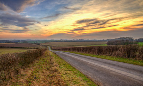
The area's fictional flavour is fitting for a place outsiders might refuse to believe exists at all – wolds are meant to belong in Yorkshire, aren't they? And everyone knows that Lincolnshire is as flat as a playing card. Yet here we are, looking out over chalky downs that roll comfortably away from us like a mildly perturbed sea.
We decide to take on the wolds' western flank, beginning our weekend's walking at the small Roman town of Caistor and following the Viking Way long-distance footpath to Donington-on-Bain, 20 miles to the south-east.
This means that our first day is spent on a ridge pleading with the skies to clear (the three towers of Lincoln cathedral, 20 miles away, can be seen in more clement weather). When they refuse, we console ourselves that we still have the wildlife to enjoy – hares, lapwings and buzzards share the fields, while snowdrops are strewn about the woods in their tens of thousands.
There is a string of diminutive dozing villages to nose around too, including Tealby (tealby.com), in which, remarkably, no fewer than 26 buildings – most of them from the late-Victorian era – are listed (britishlistedbuildings.co.uk).
After we've bagged Lincolnshire's highest point (the 168m Normanby Top) and highest village (Normanby-le-Wold), an unfriendly shower of sleet forces us to take refuge in the medieval church of All Saints at Walesby (lincoln.ourchurchweb.org.uk/walesby). This is known as "the ramblers' church" on account of a stained-glass window depicting group of 1950s-vintage walkers.
Perhaps even more astonishing are the archaeological finds displayed outside. These range from a halfpenny piece from the reign of King John to a piece of Roman amber "worth more than a slave".
As might be deduced from this, the Lincolnshire wolds have long been a popular place to settle, not least for the area's well-earned reputation as a producer of fine food. Farmers' markets, such as the one at Caistor, are not recent fads but have always been the way of things here. And when we visit the cafe at Sunnyside Up Farm (sunnyside-up.co.uk) in Market Rasen for coffee and carrot cake, we find a shop satisfyingly crammed with local victuals.
There's a cavalcade of cheeses (Cote Hill Yellow Belly is the one everyone talks about, though the unpasteurised Lincolnshire Poacher is also highly lauded), honey, ice-cream, rapeseed oil, simnel cakes, stone-ground flour, various beers and even wine from what must be some of Britain's most northerly vineyards.
"The wolds' most famous speciality is its Lincoln Red beef, though," says the farm's owner, Hazel, who has her own herd of these deep cherry-brown cattle.
The excellent field mushrooms we devour that evening at the 18th-century Advocate Arms in Market Rasen are, naturally enough, also grown in the wolds. The hotel prides itself on its local food-sourcing, which is apt in a town whose market has been going since the 1300s.
The following morning we go in search of another of the wolds' little-known assets: its hundred or so deserted medieval villages (pastscape.org.uk), victims variously of the Black Death, the Little Ice Age and clearances as vicious as any undertaken in Scotland.
Rejoining the Viking Way at Tealby, we climb gently upwards through pasture to the river Bain and pass more lost villages than real ones. We call forth the ghosts of West Wykeham and East Wykeham, Calcethorpe, South Cadeby and finally Biscathorpe, whose humps and bumps and single lone house are all that remain of a community of crofters.
Beyond, making us feel small again, there towers the gargantuan mast at RAF Stenigot, virtually all that's left of a cold war listening station – an apposite tribute to a region that has for so long stayed under the radar.
